Weather expert predicts chilly unsettled conditions in Aylesbury post-Storm Arwen
and live on Freeview channel 276
November this year has been a month of contrasts, with conditions through the first three weeks or so being much drier than average and temperatures much higher than average.
The Aylesbury Vale area saw only around 20-30% of the rainfall expected from an average November and temperatures often struggled to reach single figures during the night times.
Advertisement
Hide AdAdvertisement
Hide AdDespite the rather benign, dry and mild conditions for much of the month of November, it ended on a very different note.

On the 26th, a low pressure system situated out in the North Sea became the first named storm of the season, Storm Arwen.
Gale force winds, rain, and heavy snow affected many parts of the UK, leaving people stranded and without power.
Arwen originated just north of Greenland and not only brought gale force winds, but a change in the dominant air flow across the UK.
Advertisement
Hide AdAdvertisement
Hide AdLargely high pressure dominated and westerly flows were replaced by a strong northerly flow which lingered until 29th, and allowed temperatures to drop significantly across the country.
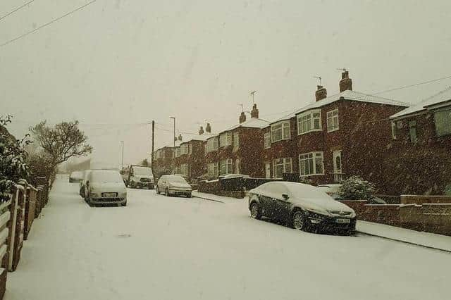
Following a particularly cold night, November 28 saw an area of sleet and snow bringing a light dusting of snow to most areas across the Vale, including the town of Aylesbury, and up to about a centremetre fell in places.
Since the 29th, conditions have turned milder but have stayed rather wet and breezy.
However, this was a brief interlude in what will continue to be a rather chilly and northerly flow dominated next few days.
Advertisement
Hide AdAdvertisement
Hide AdNortherly winds through today and tomorrow will bring showers at times and very cold nights with frosts likely.
Staying chilly and rather unsettled for the remainder of this week and into next week with some further chances of snow.